This design program served engineer customers within non-aerospace and non-defense companies who need to integrate navigation and inertial sensing for autonomous vehicle, survey and mapping and other applications. The program will drive $15M revenue in year 1, and $100M revenue over a 5-year strategic plan.
The applications noted above require extremely accurate positioning data. That data comes from Inertial Measurement Units (IMUs) and Navigation units that combine GPS/GNSS and inertial data. They also require an easy way to configure and calibrate enabling sensors.
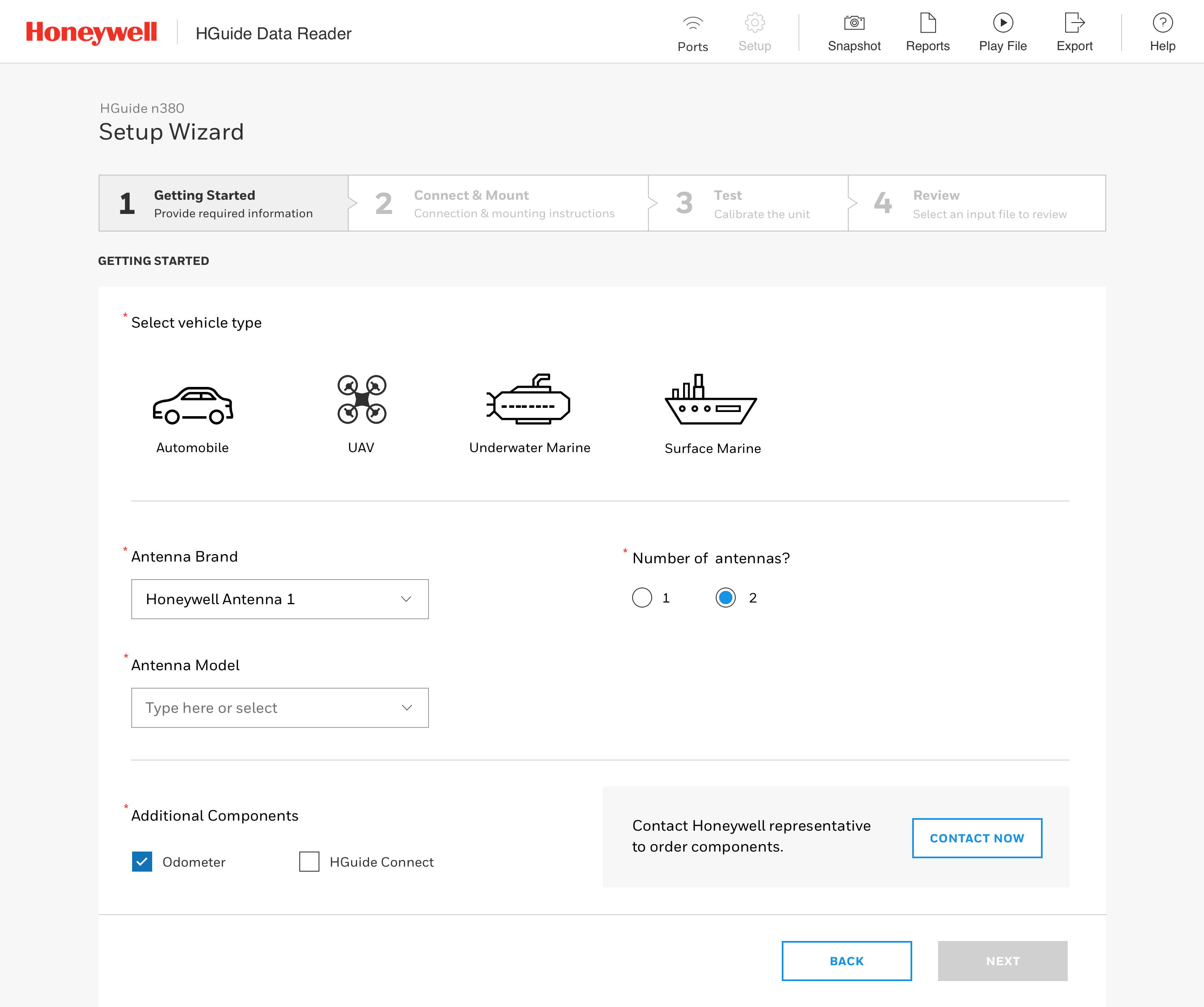
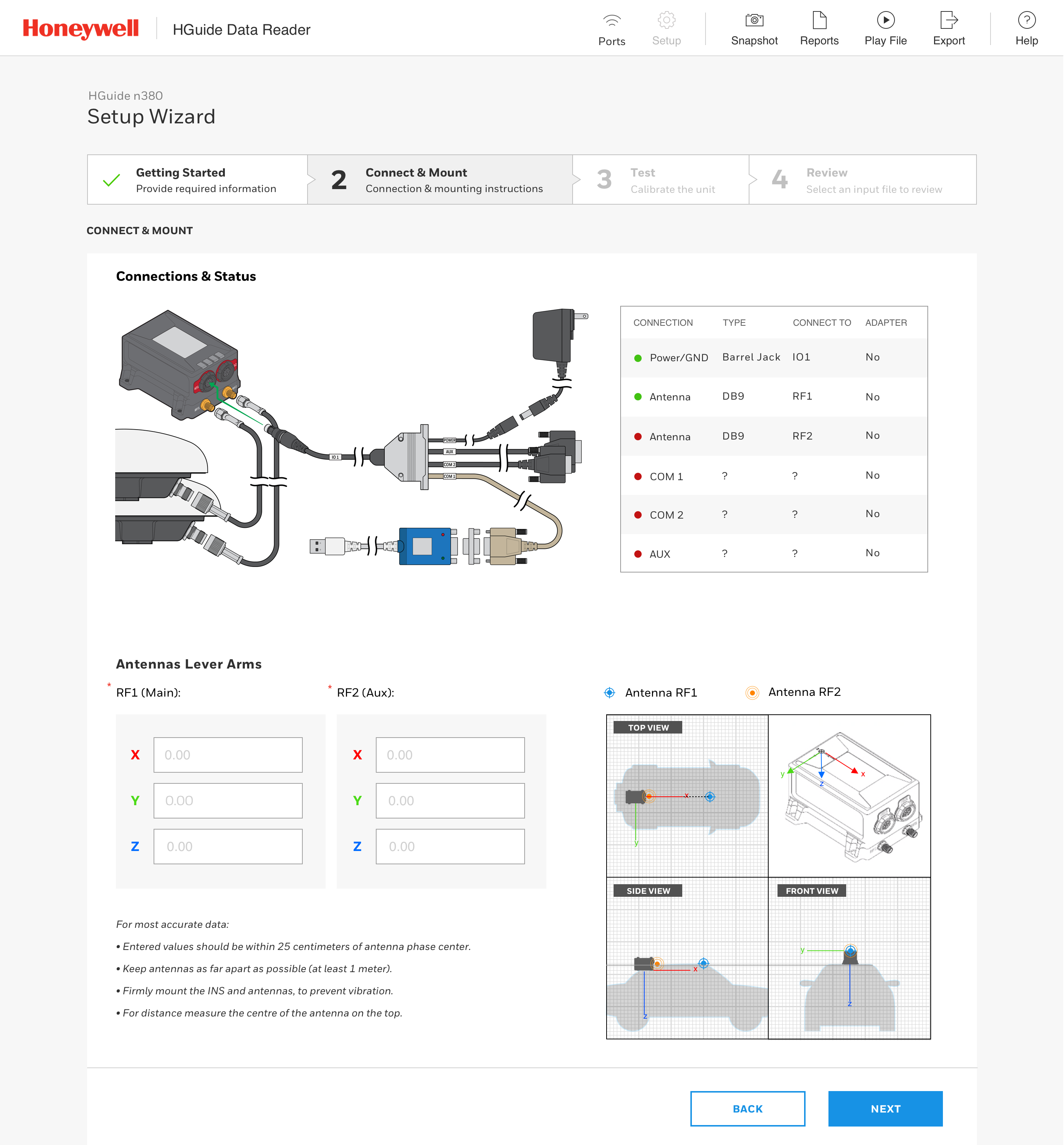
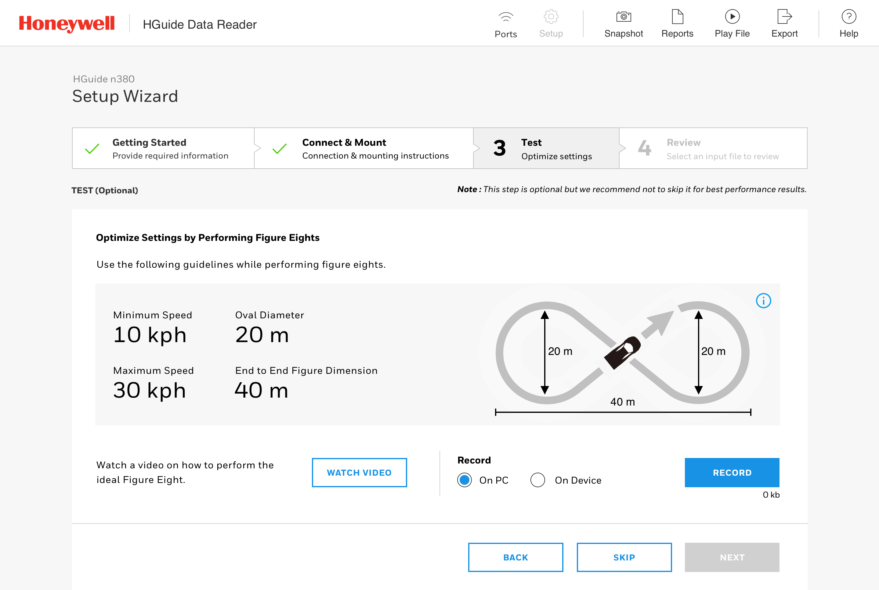
We created a guided configuration wizard that greatly reduces Time On Task and enhanced customer’s ability to evaluate offerings. In the previous interface a user needed to selected from hundreds of “messages” – scripts that combined to form a testing protocol. Now, a user can answer a few questions, select components, see an intuitive wiring diagram, test their configuration and start integrating sensors within their platforms. Design was informed by close collaboration with sensor design engineers and VOC with customers to understand efficiency pain points.
Results
- Shortened sales cycle time via faster evaluation periods
- Increased revenue from intuitive integration, larger volume orders
 AARON COOPER


